We see it all the time around Cheyenne: a contractor budgets for a straightforward excavation off I-25, only to hit a buried channel of weathered Sherman Granite that nobody anticipated. The ripper teeth bounce off, the schedule blows out by two weeks, and the change order eats the contingency. That headache is almost always preventable. Seismic tomography, both refraction and reflection, maps the transition from soil to rock before a single yard of material gets moved. When you know the depth to competent bedrock and the velocity structure of the overburden, you can plan earthwork quantities, select the right foundation type, and avoid the surprises that turn a profitable job into a loss. Our team runs these surveys across Laramie County on everything from commercial pads near the Capitol to wind farm access roads out east, and we deliver the kind of subsurface intelligence that makes estimators sleep better at night.
A tomographic velocity cross-section does what a drill log cannot: it shows you the continuous geometry of the weathering front between boreholes.
Quick answers
How long does a typical seismic tomography survey take in the Cheyenne area?
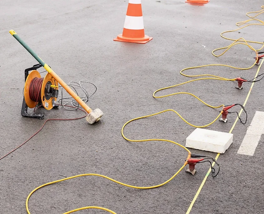
Most single-line surveys are completed in one field day. The crew arrives at sunrise to lay out the geophone spread and set off shots, and by mid-afternoon the data acquisition is wrapped up. We deliver a preliminary velocity section within 48 hours so your design team can move forward without delay.
What is the cost range for a seismic refraction tomography survey here?
For a standard commercial building pad investigation in Cheyenne, the fee generally runs between US$2.930 and US$5.380 depending on the line length, number of shots, and whether we combine refraction with MASW for site classification. We provide a fixed-price proposal after reviewing the site geometry and target depth.
Can seismic methods work when the ground is frozen in winter?
Yes, and in fact frozen ground can improve coupling between the geophone spike and the soil, giving us cleaner first arrivals. The main winter challenge in Cheyenne is wind noise on the spread cable, which we manage with sandbags and by scheduling shots during the calmer morning hours.
How do you correlate seismic velocities to rippability?
We use the Caterpillar D9/D10 rippability chart calibrated against the P-wave velocity from the tomogram. Velocities below 4,000 fps are generally rippable, 4,000 to 7,000 fps is marginal depending on fracture spacing, and anything above 8,000 fps in the Sherman Granite requires blasting or hydraulic hammering.